Landscape Connectivity Between Protected Areas in Corrientes, Argentina
Overview
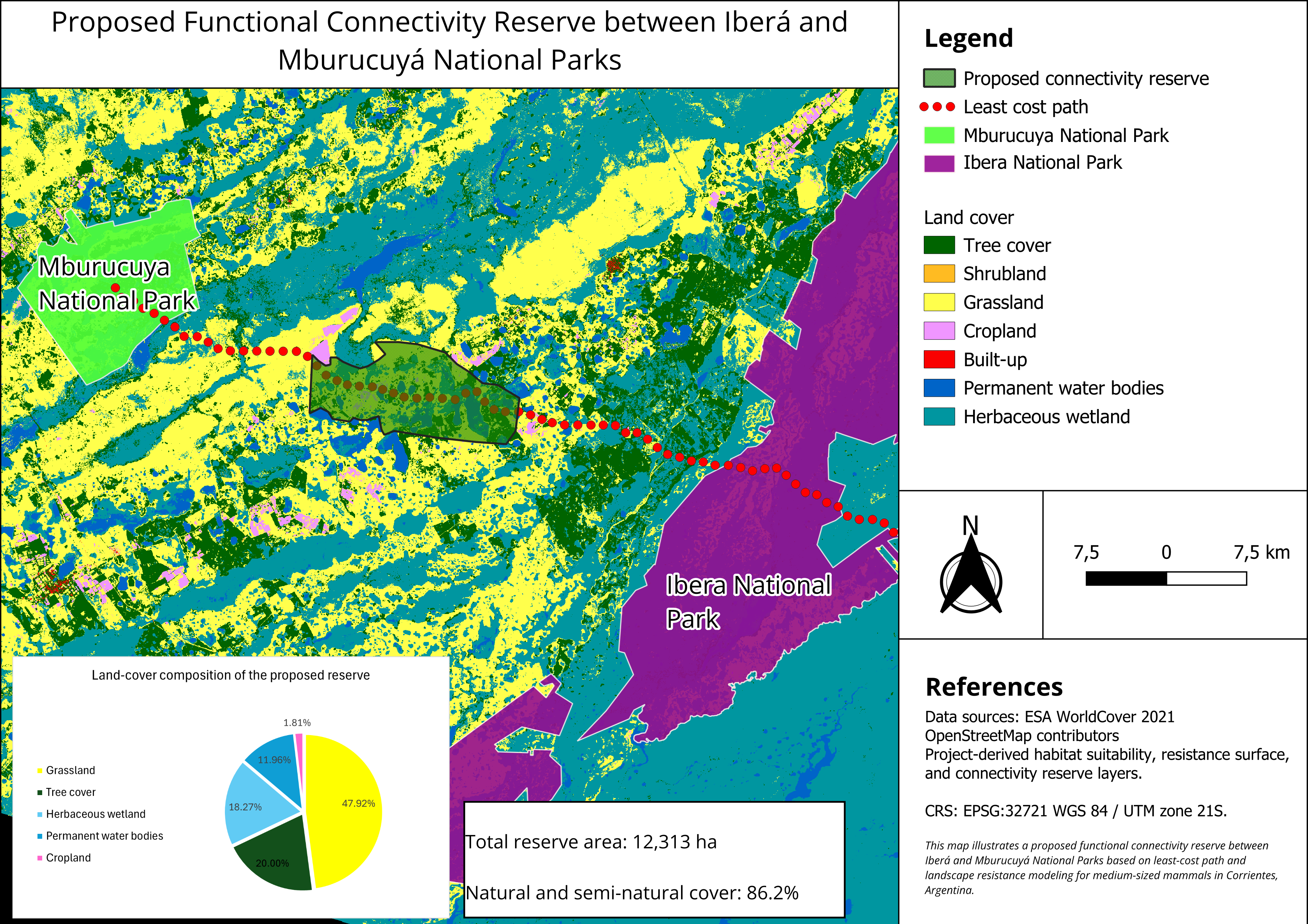
Connectivity analysis for medium-sized mammals between two protected areas in Corrientes, Argentina, using land cover and infrastructure data to identify viable wildlife corridors while minimising human impact.
Study Area: Corrientes, Argentina
Duration: May 2026
Role: Solo project
Status: Completed
Methods & Tools
Data Sources
- ESA WorldCover (land cover classification)
- OpenStreetMap (human infrastructure and roads)
Processing Steps
- Acquired and preprocessed land cover data from ESA WorldCover via Google Earth Engine
- Mapped human infrastructure and barriers using OpenStreetMap data
- Performed least-cost path / connectivity modelling for medium-sized mammals
- Delineated and evaluated the resulting corridor reserve
Tools Used
| Tool | Purpose |
|---|---|
| Google Earth Engine | Land cover data acquisition and preprocessing |
| RStudio | Connectivity modelling and spatial analysis |
| Python | Data processing and automation |
| QGIS | Visualisation and cartographic output |
Key Findings
- The resulting reserve covers approximately 12,313 ha of land
- Land cover is dominated by grasslands (47.92%), tree cover (20%), and herbaceous wetlands (18.27%)
- The corridor successfully avoids most croplands and human infrastructure, maximising habitat suitability for target species