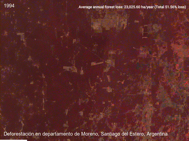
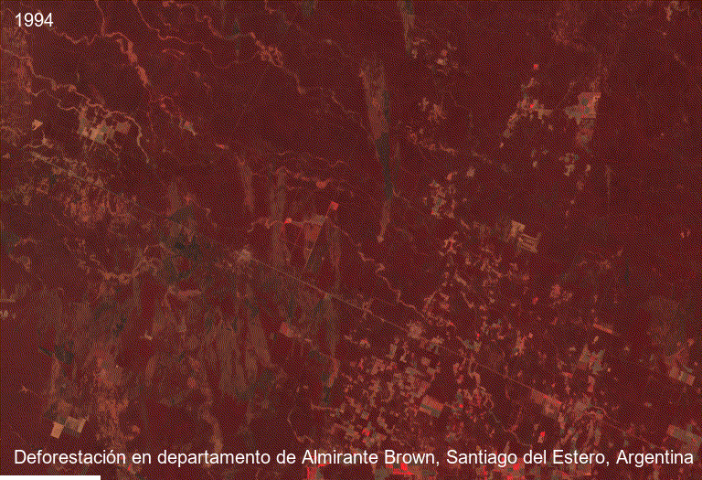
Argentinian Chaco land-use change visualization
This project presents animated spatial visualizations of native forest loss and agricultural expansion in two highly degraded municipalities of the Argentinian Chaco between 1994 and 2023.
Objective
The goal was to transform geospatial outputs into clear visual material for communicating long-term land-use change, deforestation intensity, and the spatial expansion of agricultural land.
Workflow
- Land-cover data preparation
- Forest class reclassification
- Municipality-level clipping
- Zonal summaries by department
- Animated map production
- Visual communication of deforestation patterns
Key findings
Moreno Forest loss: 667,742 ha Relative loss: 51.6% Average annual loss: 23,026 ha/year
Almirante Brown Forest loss: 492,913 ha Relative loss: 29.7% Average annual loss: 16,997 ha/year
Tools
QGIS PyQGIS Remote Sensing Land-use Change Data Visualization