Projects
A selection of my projects. Click any card to see the full write-up.
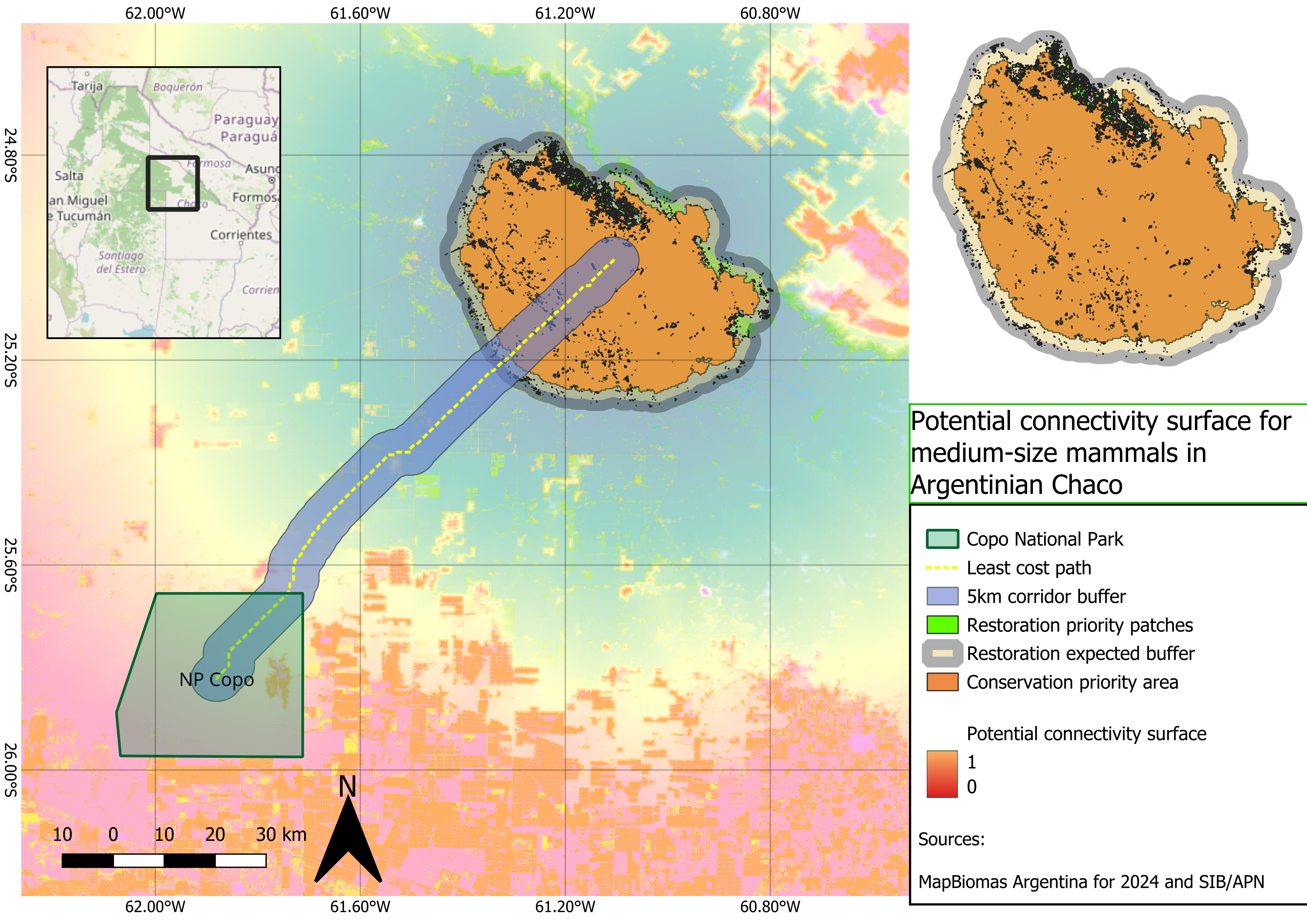
Potential connectivity surface for medium-sized mammals in the Argentine Chaco
This project models potential functional connectivity for medium-sized to large forest-associated mammals in the Argentine Chaco using a reproducible GIS workflow.
Python QGIS Connectivity Conservation Planning
Landscape Connectivity Analysis
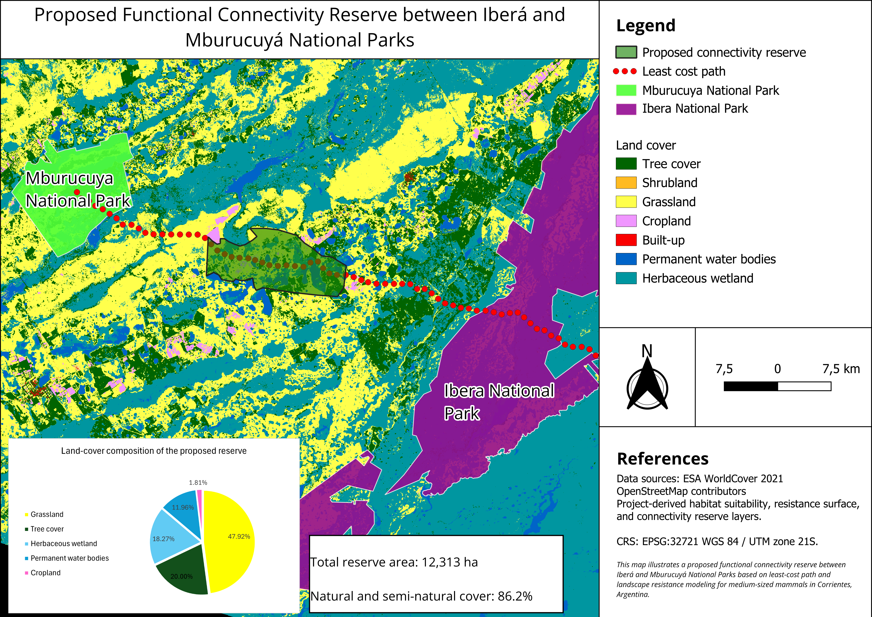
Built a proposed natural reserve to increase medium-sized mammal connectivity between two existing National Parks in Corrientes, Argentina using a least-cost path approach.
GEE QGIS RStudio
I trained a pilot YOLO species detection model using ocelot, paca, and red fox camera-trap images.
YOLO AI PowerShell Python
Argentinian Chaco land-use change visualization
Animated spatial visualization of native forest loss and agricultural expansion in two highly degraded municipalities of the Argentinian Chaco between 1994 and 2023.
QGIS PyQGIS Remote Sensing Land-use Change Data Visualization
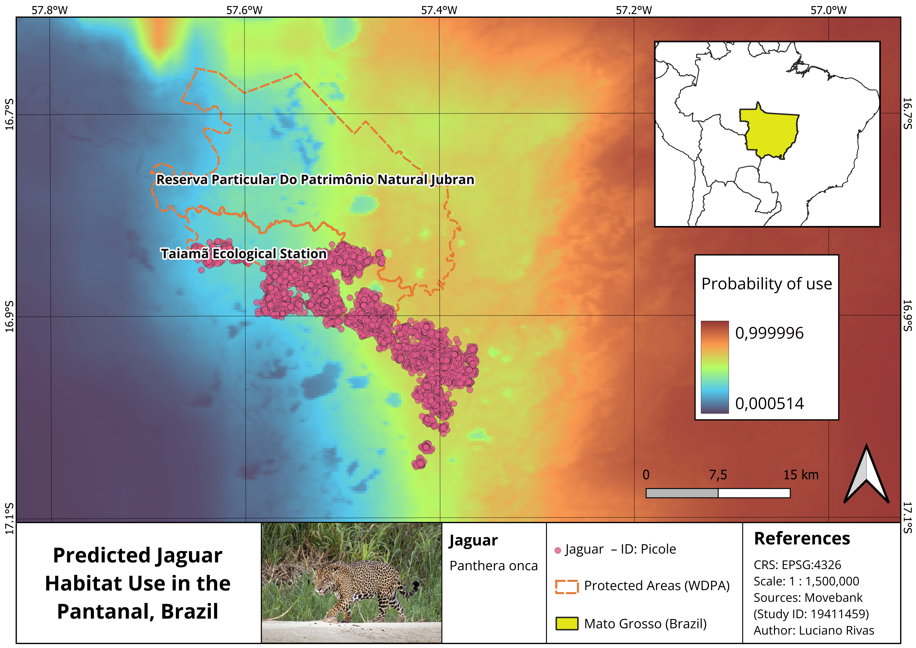
Jaguar habitat use in the Brazilian Pantanal
I modelled habitat use of a jaguar individual in the Brazilian Pantanal using GPS tracking data, QGIS Model Designer, and a Step Selection Function in RStudio.
QGIS RStudio SSF GPS Tracking Movement Ecology